Oslo
2022
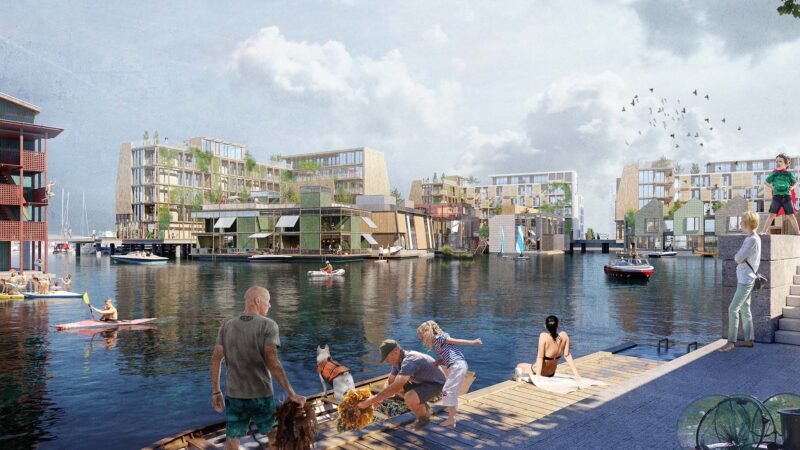
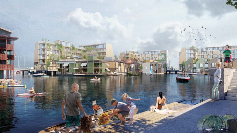
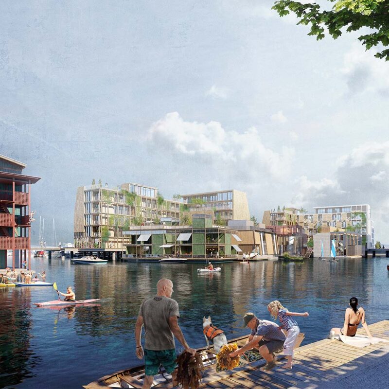
The necklace in Lagunebyen
Who are we developing the city for? For everyone!
Vandkunsten’s proposal for Grønlikaia, “Halskæden” (The Necklace), offers a plan that socially anchors the project with generous and diverse public spaces accessible to everyone in Oslo.
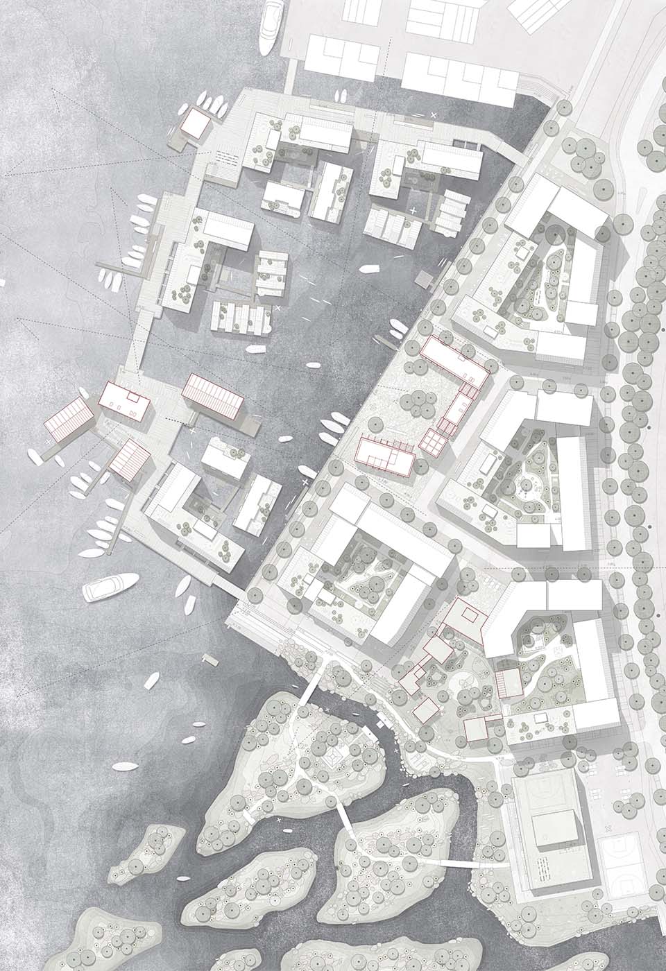
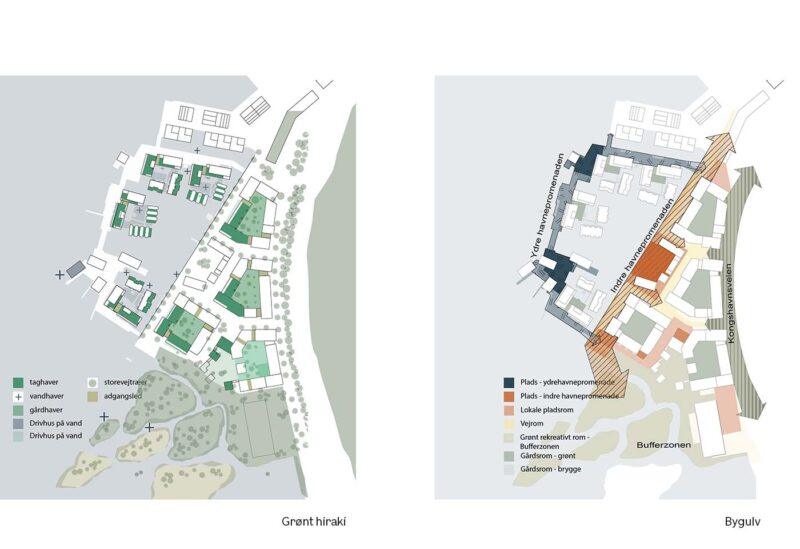
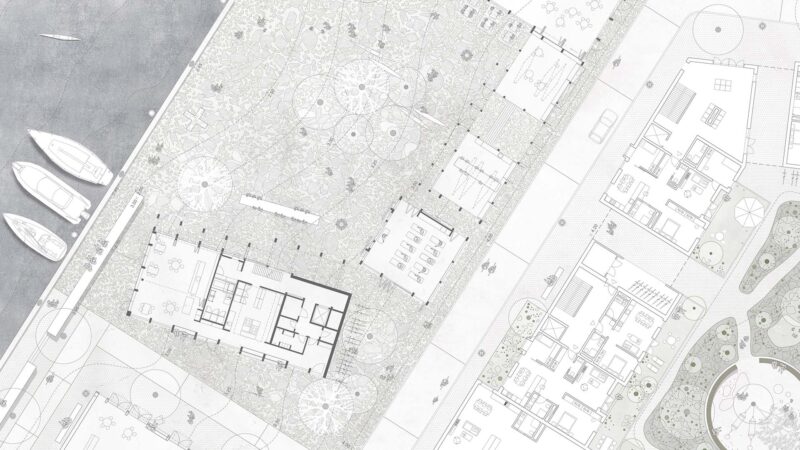
The new area provides well-defined settings for urban activities around a new central landscape space – the lagoon – a protected harbor basin with good water circulation, surrounded by floating buildings of varied scales. Central to this harbor space is the historic Blockmurskaien and a local town square called Munkehagens Centrale Torv. This west-facing waterfront space becomes the focal point for communal city life and activities.
The main concept of “Halssmykket” is based on the principle balance of the circular economy, considering the social sustainability and the Earth’s tolerance limits. To minimize the artificial creation of building plots and to exceed the Earth’s tolerance limits as little as possible in urban development, we depend on minimizing artificially created land. Therefore, the buildings are placed on the water along a pile-founded harbor promenade that encircles the inner water mirror in the lagoon, resembling a necklace. The shared gathering point arises from a necessity: Build lightly and openly, minimize artificial land, and offer optimal lighting conditions out on the water.
The blue-green strategy
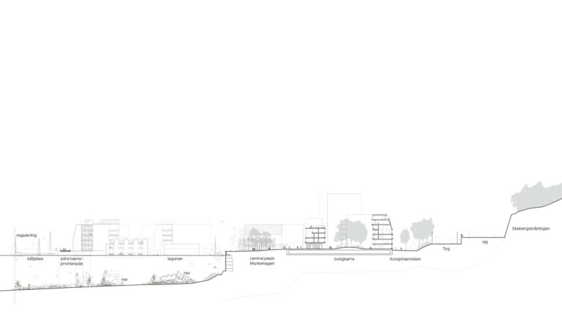
The way and boundary of Oslo’s encounter with the fjord have changed in both character and coastline over time. The city has expanded further and further into the space of the fjord. Oslo has transitioned from natural, soft, gradual transitions to more direct vertical encounters with the water surface.
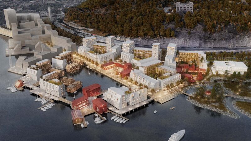
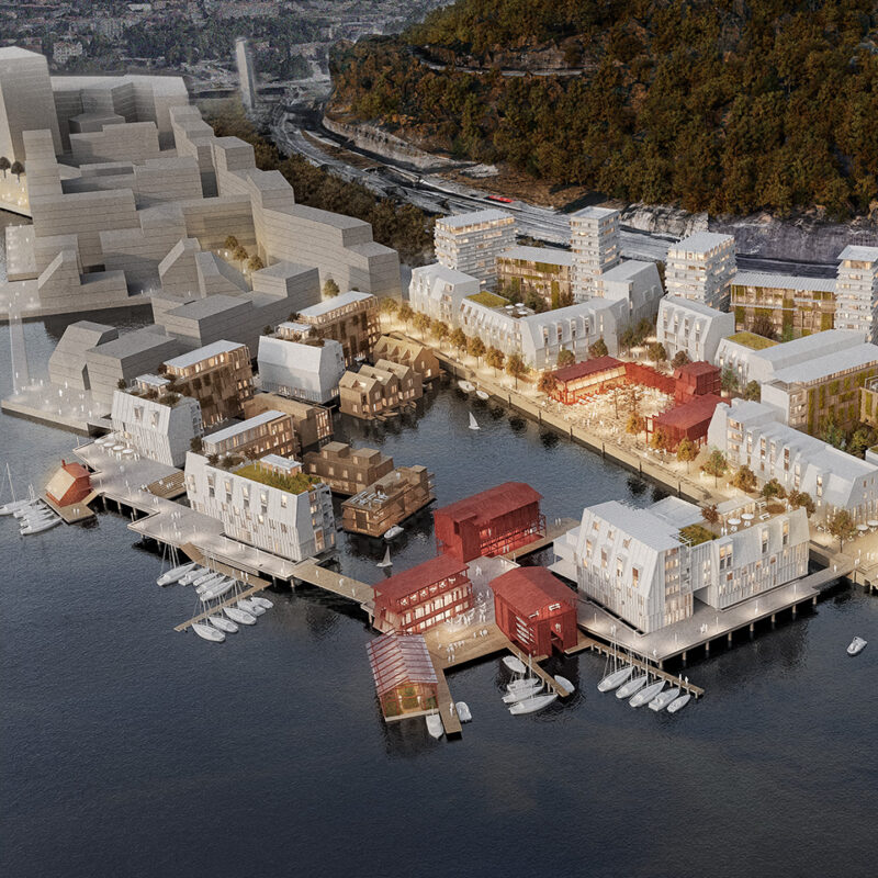
At Grønlikaia, industrial and port development has altered the boundary between land and water, and with the plans for a new district, there is further construction extending into the fjord.
We are focused on the fact that Grønlikaia has an excellent starting point for creating a new district with a strong and authentic identity. The location is truly unique, with the Ekeberg slopes behind and views of the city center, Bjørvika, and the entire fjord and islands. This is a location that carries significant responsibility.
Between land and water
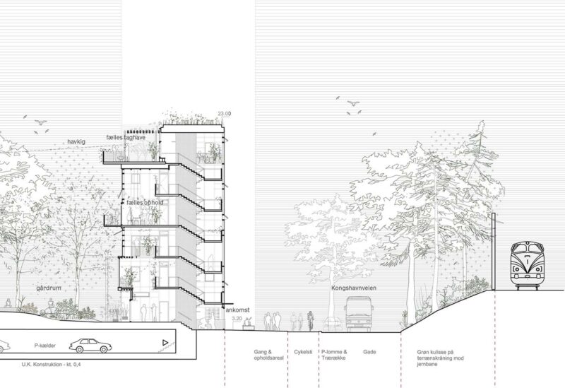
The proposal develops and nuances the transition between land and water in a diverse manner, both on a larger scale and in the smaller, intimate situations. The project is robust enough to withstand sea-level rise while preserving and enhancing the generous sightlines between the fjord and Ekeberg.
The site’s history is present in the old and beautiful Blockmurskajen, which is made into a focal point in our plan, where the quay takes on a prominent role.
Diversity is a key concept for all successful neighborhoods, and our proposal demonstrates a clear intention to capture the many small moments and situations. The public space is prioritized to be varied and identity-building, while the overall city lines remain clear and visible.
Fjord glow for everyone!
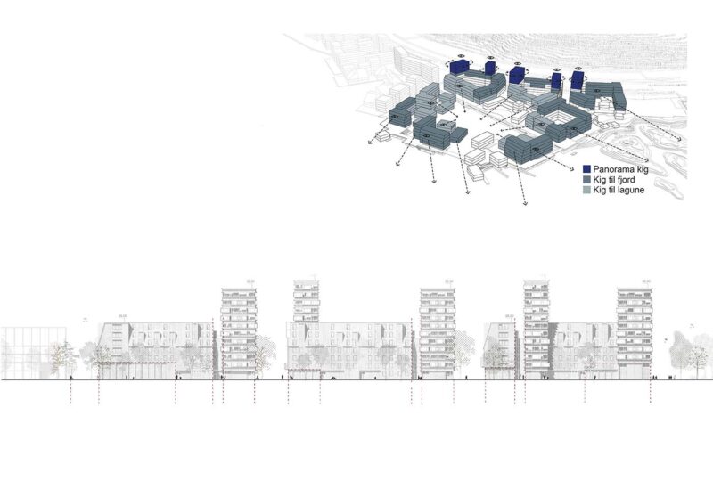
In terms of utilization, the limitation of the building’s climate impact calls for differentiation between the development on land and on the water. We increase the density towards Kongshavnveien and dilute the development on the water. This noticeable difference creates a downsizing of the district into two types of cities that are closely connected by the lagoon and the existing quay, within which the Lagunepladsen is incorporated. At the same time, the difference in density allows for optimization of the view conditions, resulting in all homes in the plan having a fjord glow! Moreover, these views are primarily directed towards the southwest, coinciding with good solar radiation.
Neighborhood and Housing
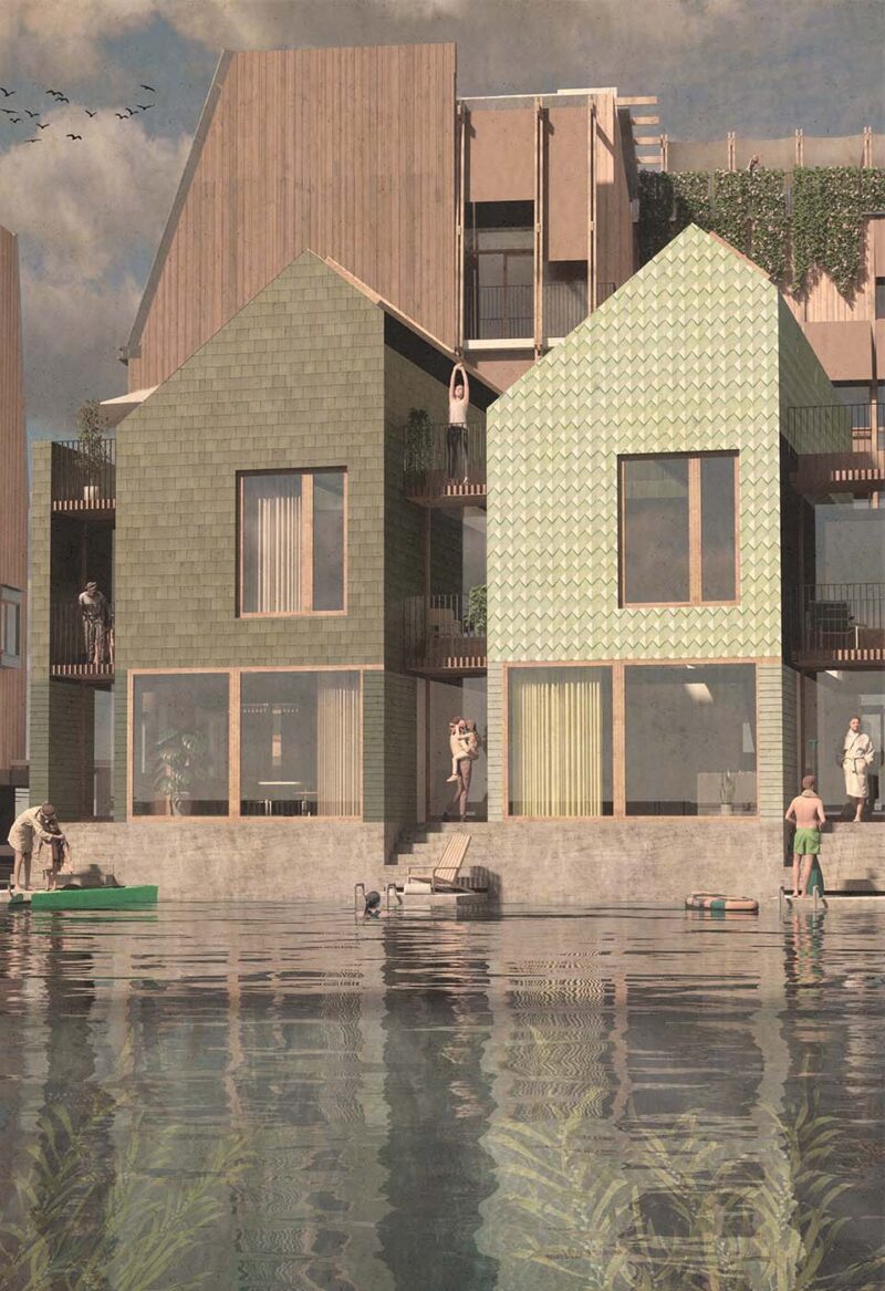
Lagunebyen is differentiated through a hierarchy of building typologies. This range of typologies allows for the creation of a rich variety of housing types, ensuring a diverse and differentiated mix of residents. Small and large households, different income groups, and people of different ages will be able to find a place in the neighborhood.
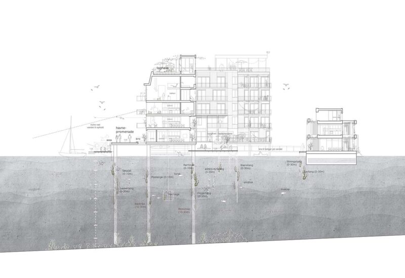
The marine environment
To minimize climate impacts, the project utilizes a range of foundation types. The development of the bridge is designed to ensure water flow in the area. By avoiding land reclamation and sheet piling, and by minimizing pile foundations and building density on the water surface, a nearly barrier-free flow is achieved. The water in the lagoon remains clean and healthy for recreational activities and the marine life on the seabed and in the water. Based on this foundation, efforts can be made to stimulate marine biology through planting and manipulation of the seabed environment to establish an ecosystem.
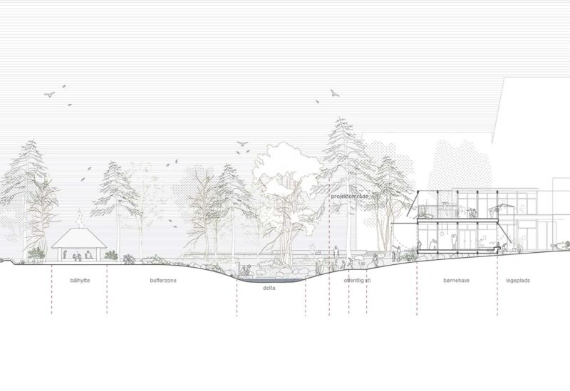
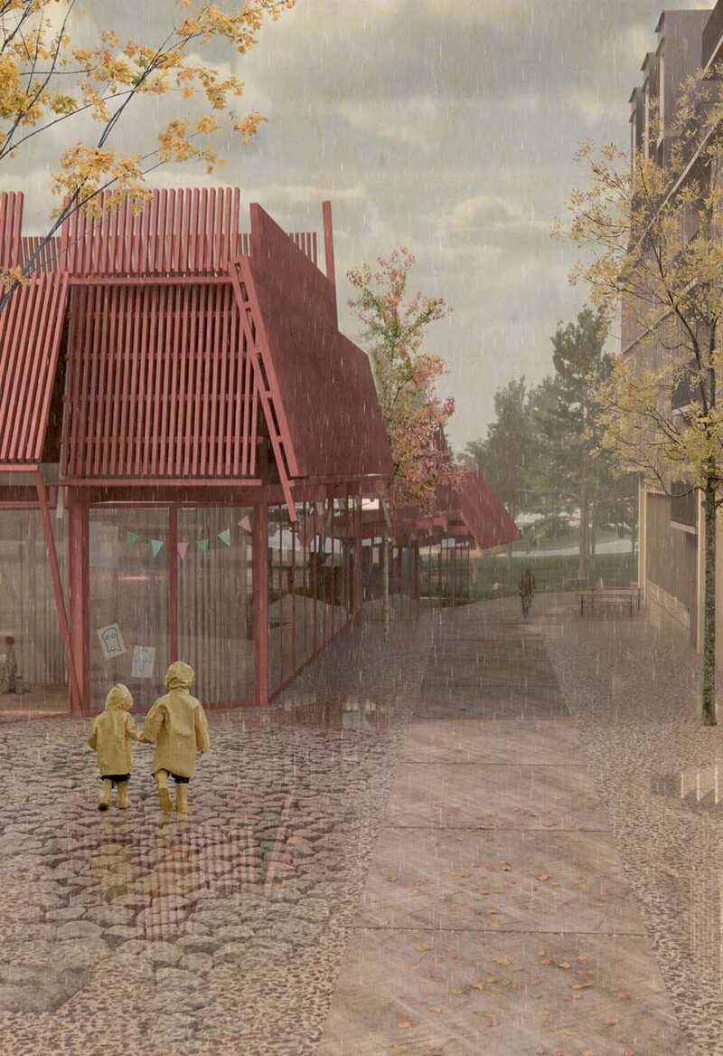
Kindergarden by the fjord
The location of the kindergarten, sports center, and cultural house at one of Oslo’s most beautiful viewpoints and new landscape with the buffer zone creates synergy and a new focal point that adds identity and a beautiful endpoint to the journey along Oslo’s harbor promenade.
Community and business
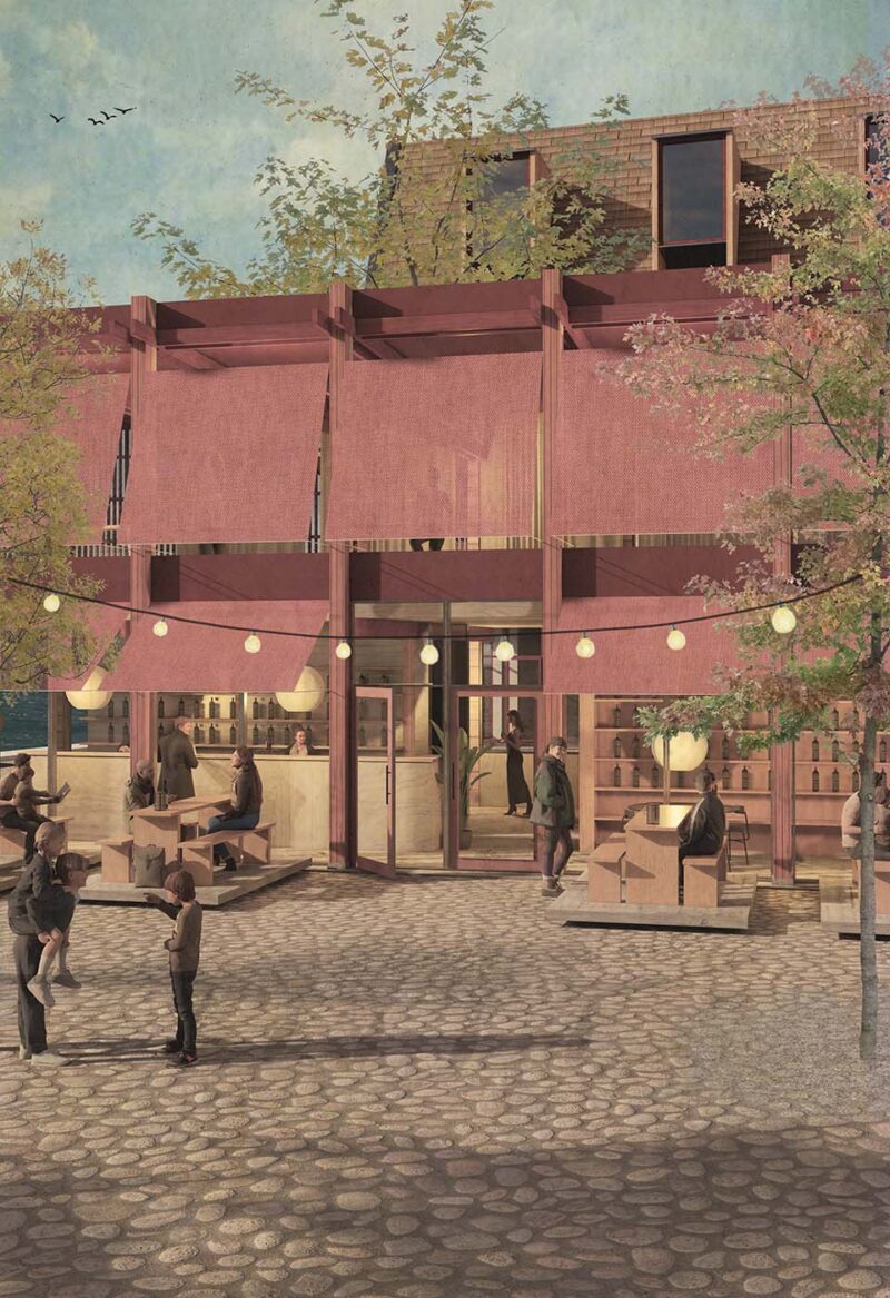
Non-commercial activities are evenly distributed throughout the development and targeted towards different types of city residents. Everyone can freely use the pier and boat docks for swimming and leisure. Access to enjoying the view towards the southern landscape is available to all. The neighborhood could stand alone in this manner, but the addition of commercial activities such as a sauna, sailing club, ice cream stand, shops, restaurants, and cafes provides the opportunity to enhance one’s experiences on-site. Thus, a robust hierarchy of activities is established, which is independent of commercial success on one hand, while on the other hand, it creates the best conditions for operating service and experiential businesses. This combination serves to bring life to the public spaces throughout the year, at all times of the day, and thereby ensuring a sense of safety for residents and visitors.
City life and recreation
With its distance from Oslo city center, Halssmykket is not the place for nightlife and shopping, but a local residential area with a strong interface with the public through an abundance of recreational qualities.
The balance between the public and the private becomes an important factor in creating the greatest overall value. Instead of overt territorial markings, fences, and signs indicating “private,” we propose discreet markings in the terrain or through the design of the access system. Courtyards within the blocks are private, but physical barriers create a dismissive and ungenerous character. On the other hand, a few steps up to an elevated green level does not exclude anyone, but it signals that one is leaving the public zone. A narrow footbridge to a houseboat or a pathway that leads to a dead-end clearly indicates private territory.
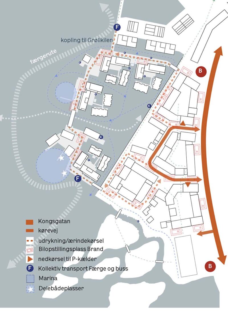
Carfree city
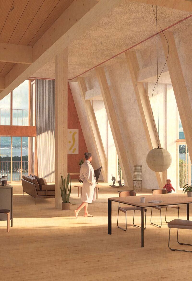
In the floating city, there is no parking available, and the buildings are constructed with wood, which has a relatively low weight and therefore requires fewer piles and pontoon decks to support them. Parking facilities are located towards Kongshavnveien, either at ground level or as parking structures. Cars are directed into the parking facilities upon arrival in the area, ensuring that the entire area remains free of car traffic, with the exception of service vehicles.
Project Facts
Building Data
Project Name: Munkehagen, Grønlikaia
Category:Boliger, Kultur & institutioner, Planlægning
Client: Hav Eiendom
Location: Oslo
Date: 2022
Status: Ongoing
The Task
Program: Housing, detail, culture and institutions
Activity: City planning
Job Type: Parallell competition
Contact Group:Elena Astrid Rojas, Emma Hansson, Søren Nielsen, Nanna Larsson, Laura Rahbæk Larsson, Ilias Ben Chaabane, Julie Ejlers, Nel Jan Schipull, Jan Albrechtsen, Pernille Schyum Poulsen
Consultant Team
Architect: Vandkunsten, Brendeland og Kristoffersen, R21 and Gartnerfuglen
Landscape: DETBLÅ
Consultant: Leva, DHI and Røisland & Co